
.png)
Table of contents
Introduction
Every construction plan starts with certainty, until the ground rewrites it.
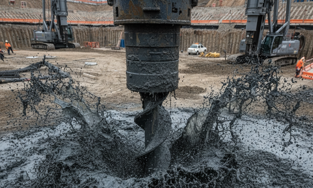
At a hyperscale data center site in the Midwest United States, the bore logs told a simple story: consistent soil, no red flags. Then drilling began. The rigs struck groundwater at 12 feet, far above the predicted level. Excavations flooded, pumps ran non-stop, and engineers debated whether to extend piles or redesign the foundation entirely.
The delay stretched into weeks. Schedules slipped. Costs followed.
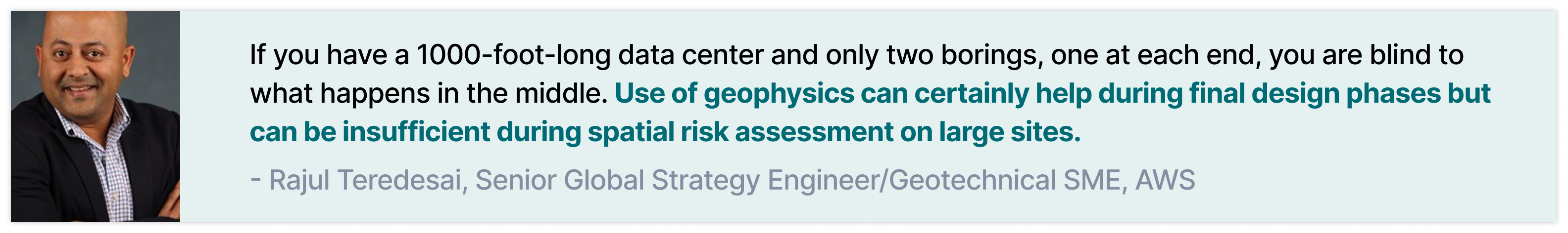
“If you have a 1000-foot-long data center and only two borings, one at each end, you are blind to what happens in the middle. Use of geophysics can certainly help during final design phases but can be insufficient during spatial risk assessment on large sites.” says Rajul Teredesai, Geotechnical Strategy Engineer, AWS
Across large infrastructure projects, unexpected change orders account for an average of 10% of the contract value, and construction rework and delays cost the industry around $177B annually in the United States.
On a $1B campus, even a 10% jump in costs is the difference between hitting a milestone and rewriting a budget.
Meanwhile, hyperscale construction is moving faster than ever. Data centers are doubling in footprint. Multi-site industrial parks, logistics hubs, EV plants, and giga-factories are expected to move from site selection to operation within 18 to 36 months.
Everything above ground is tuned for speed and predictability. Yet many of the biggest change orders still come from below ground. Unknown or poorly constrained subsurface conditions translate into differential settlement, groundwater uplift, compressible or undocumented fill, and foundation redesigns that ripple through structural and MEP scopes.
Hyperscale builders are not failing. The subsurface data they rely on is limited in space and time. It is too sparse, too static, and too disconnected from how the ground actually behaves across the full footprint and through the full construction lifecycle. This is where the idea of an AI co-worker begins to matter. An agentic system that continuously connects scattered site data, documents, and remote ground measurements to form a complete view of critical site conditions.
Why Ground Stability Is Still a Construction Blind Spot
Every large build starts with a quiet assumption: the soil beneath one corner of the site behaves the same as the soil beneath the other. Geology rarely agrees. Beneath even a flat parcel, the bearing stratum can dip, swell, or disappear. In some formations, rock pinnacles rise unpredictably. In soft or swampy ground, water pressure and consolidation change over months rather than days.
1. Mischaracterized Bearing Strata
Rajul Teredesai puts it plainly: “When your borings miss the rock highs or voids, your design is an illusion.”
That illusion becomes expensive when foundations meet unexpected resistance, or none at all. Piles hit refusal earlier than expected or have to extend thirty feet deeper than planned. On precast projects, pile splicing is not desirable, so new piles must be ordered, reengineered, and reinstalled. A few misread meters of rock can disrupt an entire foundation package and push structural work off its planned path.
On a hyperscale site, this problem is magnified. A typical investigation may cover 20 to 80 boreholes across 10 to 50 acres. Most of the platform has no direct measurement. Variability between boreholes, especially at depth, remains invisible until the piling crews discover it in real time.
2. Water and Soft Soil Settlement
If bedrock misleads designers, groundwater misleads everyone. In soft or swampy soils, settlement continues long after construction teams would like to move on. Preloading and surcharging are useful, but proof of stabilization still depends on a small number of settlement plates and survey points. Measurements are taken manually, separated by days or weeks.
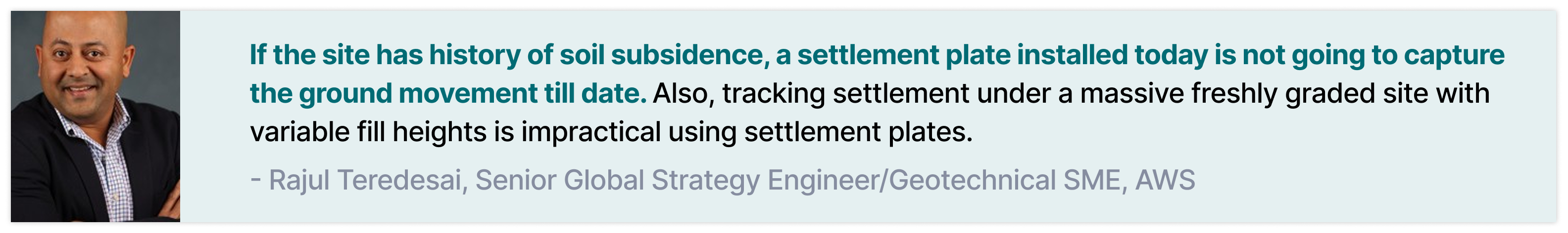
As Rajul notes, “If the site has history of soil subsidence, a settlement plate installed today is not going to capture the ground movement till date. Also, tracking settlement under a massive freshly graded site with variable fill heights is impractical using settlement plates.”
In reality, the ground is evolving throughout the project.
- Surcharge settlement
- Groundwater recharge, seasonal shrinkage and swell in clays, stormwater events
- Heavy equipment traffic, drainage path adjustments,
- Backfill decisions and grading changes
All of the above alter how the soil behaves. Earthworks move quickly across large platforms. Geotechnical data is not updated with the same frequency.
The consequence is a waiting game. Without proof that the ground has stabilized, crews hold off on pouring slabs or installing substations. And then it results in idle equipment, mounting labor costs, and calendar pages turning while the soil quietly consolidates.
3. Fragmented Evidence Across Teams
Sometimes the information needed to understand ground behavior exists, but it is fragmented.
- Civil teams hold grading plans and drainage layouts.
- Contractors maintain compaction records, backfill logs, and ground improvement reports.
- Geotechnical consultants submit PDFs that sit in shared folders.
- Drone operators deliver periodical imagery.
- Water management teams track pumping rates and seepage issues.
- Inspectors write notes into separate systems.
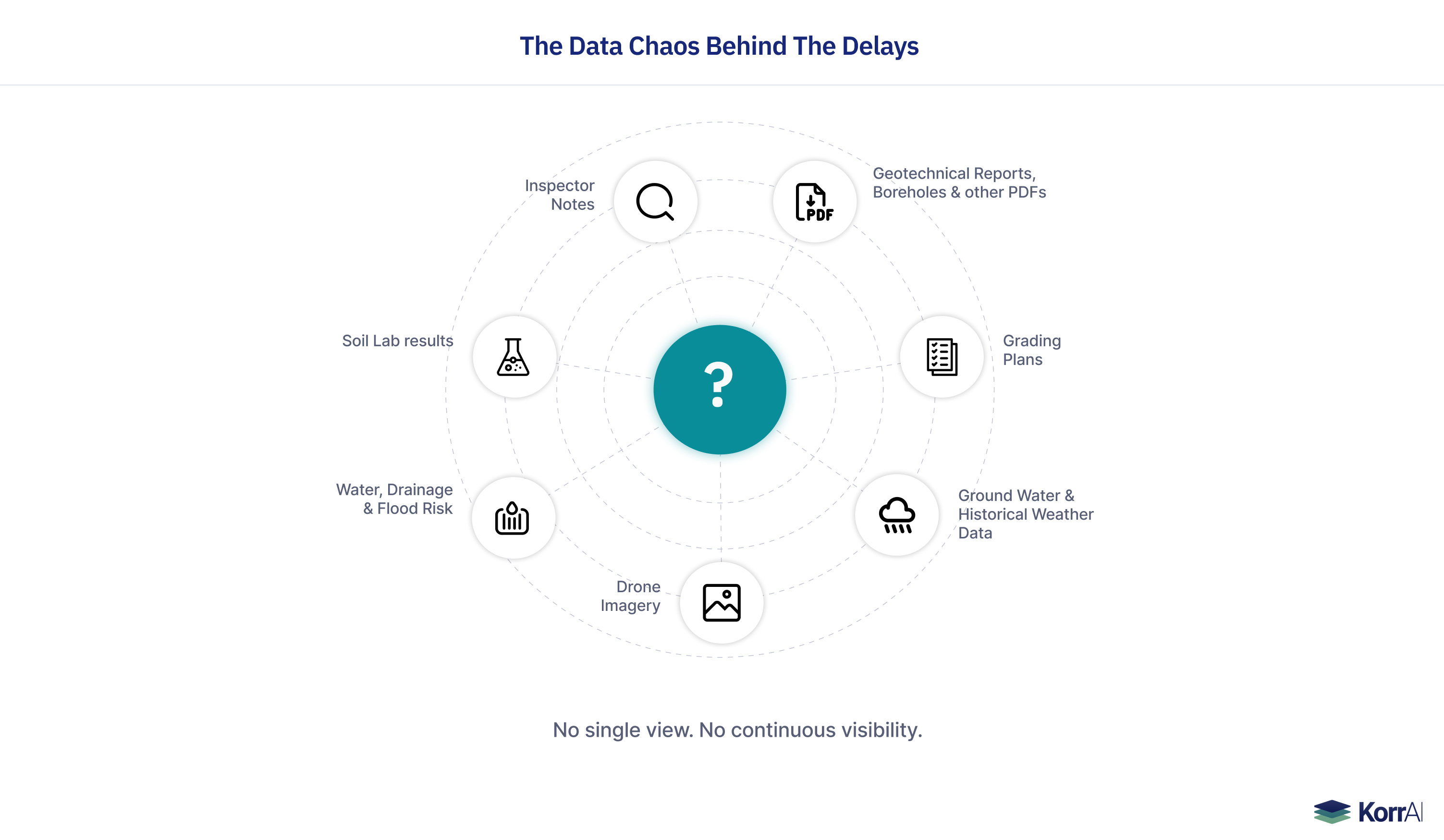
Though there is no multi-year record or wide-area trend investigation, each of these datasets is useful on its own. But they rarely form a single, coherent view of how the site is behaving as a whole. Multi-year deformation analysis for site investigation and periodical stability-checks can be supported with help of satellite or ground based radar sensors, but the traditional vendors deliver data that are typically difficult to interpret and remain disconnected from construction context.
Risk engineers and project directors spend hours or days reconstructing the ground story from meetings, emails, and all the disconnected files. By the time they have an answer, there is already a significant delay.
4. Manual Due Diligence Cannot Keep Up With Construction Size and Velocity
For a single asset owner, multiple sites may be in development in parallel. Risk and geotechnical teams do not scale at the same pace. This imbalance forces teams to trade depth for speed, RFIs stack up, and judgment-based decisions replace data-informed decisions. Later, these decisions cause redesigns that disrupt the schedule.
Local anomalies in settlement or groundwater behavior naturally take longer to catch, as they need multi-source data to be connected and correlated. When not given what it takes, the result is: redesigns, structural defects, and change orders.
The Business Impact of Poorly Verified Strata and Water Table
Where Projects Lose Time and Margin
- Pile redesigns and deeper strata force new structural calculations. Procurement teams reorder materials, often at a premium cost, and remobilization has to be planned for crew and materials.
- Each delay pushes back power-on milestones and handovers, disrupting downstream scopes like mechanical and electrical works.
Eventually, the project reaches the difficult question: Who pays for the delay?
Projects Still Wait When The Ground Has Stopped Moving
Settlement plates or survey points give fragmented visibility of stability. A plate might show the soil has stabilized, while another zone, far from the plate, still settles unseen.
Without complete visibility, teams default to caution: “Let’s wait another 30 days.”
The tools aren’t wrong; they are too narrow. Manual and point-based methods give snapshots instead of full coverage. As a result, projects keep waiting longer than needed.
Existing Services Provide Only Pieces of the Puzzle
Asset owners often end up piecing these datasets together on their own. What they need instead is a platform that connects geotechnical reports, boreholes, drone imagery, satellite measurements, grading plans, and field logs into one coherent view of how the ground is behaving throughout the project lifecycle.
Introducing TRAIL for Asset Owners
Across most construction projects, ground monitoring looks the same: a handful of boreholes, a few settlement plates, and survey checks taken every few days. It is enough to meet compliance, but not enough to monitor stability proactively during foundation, piling, and excavation activities.
KorrAI’s technology fills this gap by providing continuous ground stability intelligence across the lifecycle of a construction project. The stack combines satellite InSAR, GNSS sensors, elevation models, and a proven processing chain powered by AI. Instead of treating these as separate tools, TRAIL brings them together into practical, standardized workflows that asset owners can use in crucial decisions before, during, and after construction phases.
TRAIL Playbooks for Hyperscale Construction
Playbooks are structured analysis flows inside TRAIL that focus on a specific category of ground risk. Each Playbook combines remote sensing data, historical evidence, site documentation, and engineering logic to answer the practical questions stakeholders face during earthworks, foundations, and vertical construction.
A Playbook analyzes the information across boreholes, drone imagery, grading plans, satellite data, groundwater indicators, geotechnical PDFs, and site surveys, then aligns it into a single interpretation that teams can use immediately.
Rather than switching between datasets, project teams get one place where the evidence is connected and updated as conditions change.
{{services-widget}}
How TRAIL Fits the Hyperscale Construction Lifecycle
Pre-Development and Site Selection
Evaluate multiple parcels for ground-related risks.
Identify subsurface hazards before entering into agreements.
Spot early indicators of groundwater, fill, or mine-related concerns.
Pre-Construction Due Diligence
Cross-check geotechnical reports with site wide evidence from the Playbooks.
Validate grading concepts against historical ground behaviour.
Identify potential redesign triggers before structural packages are locked.
Earthworks and Ground Improvement
Track settlement as it develops.
Detect issues in fill placement, compaction, or backfill quality.
Monitor surcharge performance and understand when the site is ready to advance.
Vertical Construction
Catch abnormal settlement beneath slabs or foundations.
Identify areas influenced by groundwater uplift.
Confirm that excavation and trench behaviour align with design expectations.
Handover and Long-Term Operations
Continue monitoring through the first years of operation
Detect uplift, drift, or moisture-driven movement early.
Maintain evidence that supports warranty reviews or during contractor disputes.
Closing Remarks: Solving Subsurface Uncertainty and Surface-level Chaos
Hyperscale construction moves fast today, but the ground doesn’t follow a schedule when it moves. Most delays and redesigns stem from limited visibility into how the subsurface behaves as earthworks progress and loads change across the site. Boreholes, surveys, satellite data, terrain models and isolated reports provide important information, yet it’s not possible to capture the complete picture in manual capacity, especially with the perfection that these projects demand.
TRAIL gives the asset owners and builders what has been missing: a continuous, connected, multi-layer evidence platform that helps escape the data hunting, avoid partial judgement, and acts more like a co-worker to help you take informed decisions.
Our goal is simple: To bring complete situational awareness of the ground beneath construction projects, signalling instability way before it becomes a multi-million-dollar headache.
Connect with our team of experts to learn how TRAIL can strengthen your next project. Book A Meeting | KorrAI
Share this post
Written By


Rajul Teredesai
Senior Global Strategy Engineer/Geotechnical SME, AWS
Rajul leads geotechnical risk mitigation for hyper-scale data center projects across six continents at Amazon Web Service (AWS). A licensed Professional Engineer and board-certified Geotechnical Engineer with 23+ years of experience, he specializes in infrastructure risk management for critical commercial and government facilities worldwide.
.png)
Rahul Anand
PDG et cofondateur
Rahul est PDG et cofondateur de KorrAI. Entrepreneur en série, il a déjà bâti des entreprises prospères dans les secteurs de l'Internet grand public et de l'IoT. Il vise maintenant à lutter contre l'affaissement du sol, qui devrait toucher plus de 25 % de la population mondiale au cours des prochaines décennies.
Written By

Team KorrAI


Ground Motion Risk

Water & Drainage Risk

Piling Risk

Site Evolution

Document Intelligence

Multi-Hazard Overlays
Nous envoyons à l'occasion des courriels contenant des mises à jour, nos derniers blogues et nos lectures préférées sur InSAR et le paysage lent de l'affaissement du sol.
Abonnez-vous à notre infolettre
Lu par les meilleurs professionnels sur
.webp)


Je vous remercie ! Votre soumission a bien été reçue !
Oups ! Quelque chose s'est mal passé lors de la soumission du formulaire.
.webp)
KorrAI identifie les menaces que représentent les mouvements au sol pour les infrastructures essentielles à l'aide des données InSAR provenant de satellites et de réseaux de capteurs au sol.


Droit d'auteur
.svg)
2025 KrAi