


Ground Deformation Monitoring,
Calibrated For Precision
We have enhanced InSAR's reliability by calibrating satellite data with public and proprietarty ground-based GNSS sensors to deliver millimeter-level accuracy.
.webp)
Building the world's most accurate ground monitoring solution
Our Ground Monitoring Technology Stack
From a processing engine that handles over a petabyte of data every year to our state-of-the-art calibration framework, we're building the world's most sophisticated ground monitoring solution.

Interferometric Synthetic Aperture Radar (InSAR)
InSAR relies on satellite-based radar signals to measure ground deformation by analyzing signal reflections over time. Our sophisticated data processing algorithms process data from several satellites and monitor for ground movement.


InSAR Calibration Using GNSS
While InSAR is accurate, factors such as atmospheric noise can introduce errors and distortions. In an industry-first, our algorithms utilize data from public and proprietary GNSS stations and corner reflectors to improve precision and accuracy of ground deformation measurements.
Amplitude Dispersion Index (ADI) For Improving Error Estimation
InSAR detects subtle ground deformation by analyzing radar signal reflections over time. The Amplitude Dispersion Index (ADI) helps identify stable targets, ensuring precise deformation analysis.
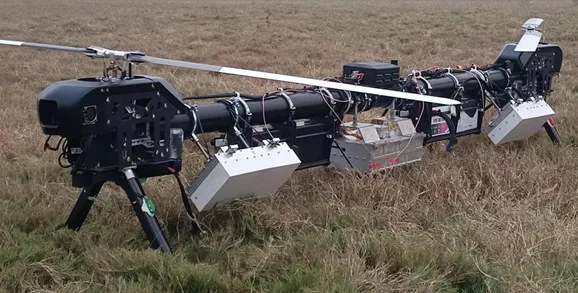
Drone InSAR: Augmenting Satellite-Based Data Sources
Satellite-based InSAR excels at monitoring large regions or multiple sites regularly. Drone-based InSAR augments this with high-res monitoring of specific structures or areas in a site. This further increases accuracy and responsiveness for critical areas or hotspots.
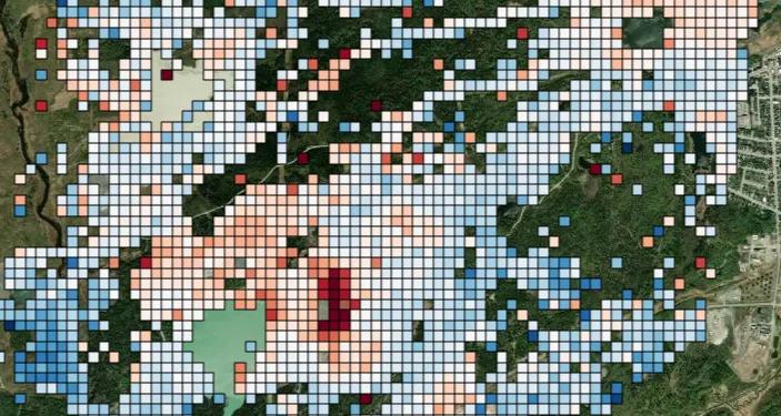
Industry-Leading Accuracy & Wide Area Monitoring
.webp)


Ground Deformation Risk, Native to TRAIL
When TRAIL runs an analysis based on user query or a playbook for site risk assessment,
ground motion data populates through API, without switching between platforms.
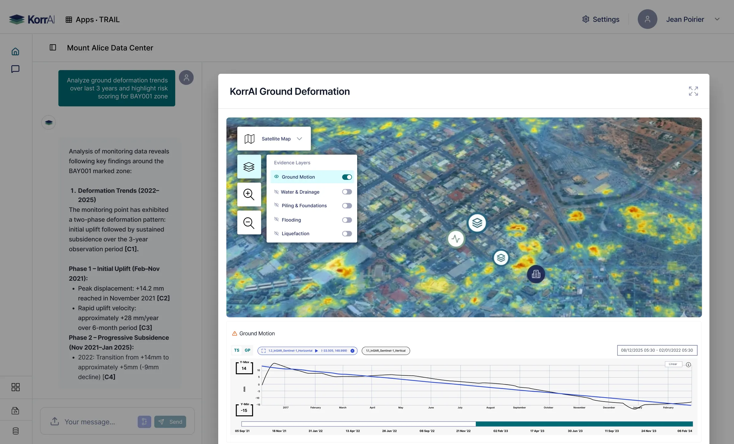
How TRAIL Uses Ground Deformation Data?
TRAIL runs customized time series analysis based on project information and user queries. It surfaces historical insights and dynamic risk grading (L/M/H).
Analyze subsidence trends across the site and flag concerns
Cross-reference patterns with soil boring logs and geotechnical reports
Assess temporal movement behavior (accelerating vs. stable vs. seasonal)
Trace findings back to specific InSAR time series and sensor validation data
Deformation Risk Within Assessment Workflows.
Explore How TRAIL Expedites Risk Assessments
Check out the AI-Native Platform and it’s core features that help you accelerate decisions.
Speak With Our Team


.webp)
.png)


.svg)
.webp)