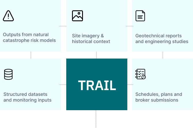
NatCat
• Flood
• Wildfire
• Wind
• Seismic
• Extreme rainfall

.svg)


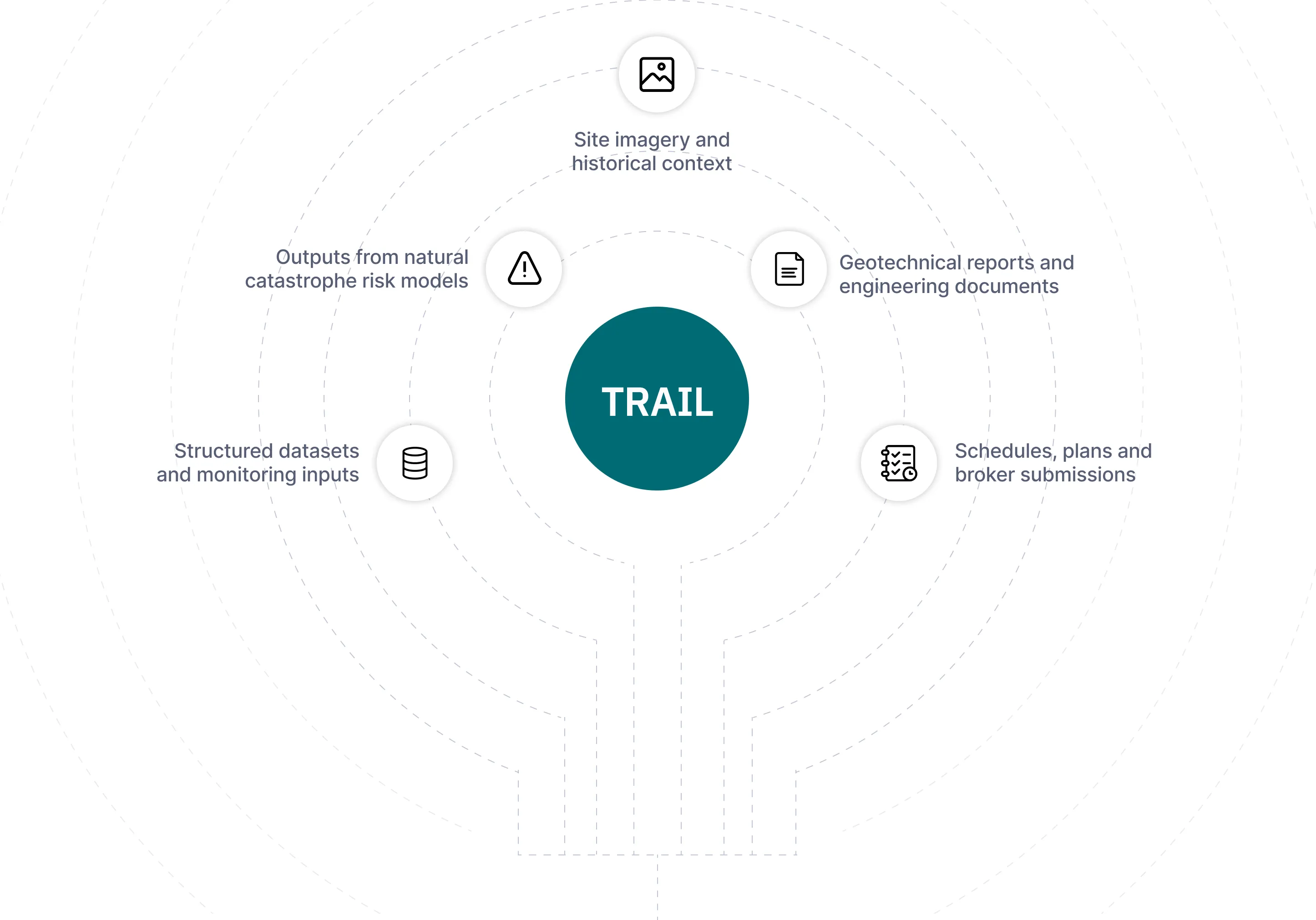
Engineering reports, site history, and natural hazard models stay disconnected across channels.
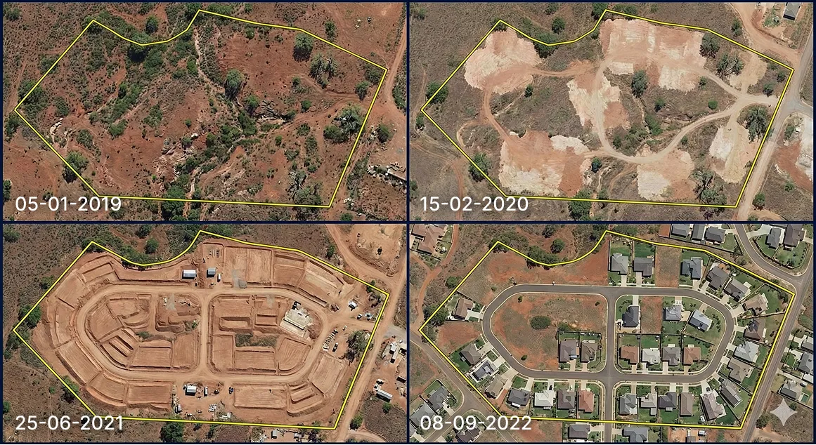
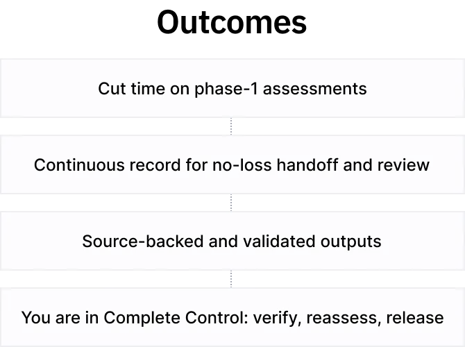
Geotechnical investigation and instrumentation cover just ~15% of Project Footprint.
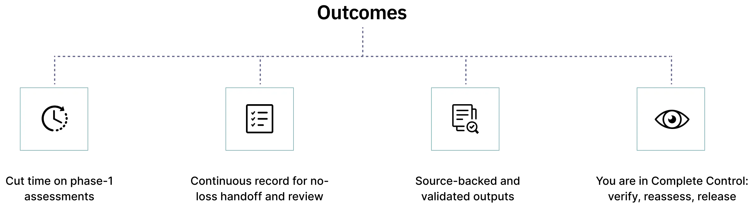
No continuous record of decisions and linked evidence. Critical context is lost during handoffs.
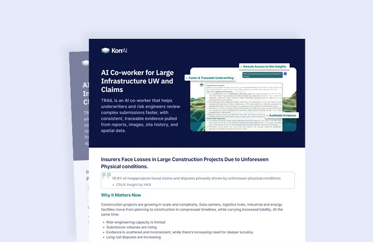
A four-page overview of TRAIL platform, it’s evidence layers and features.

Playbooks are AI-reasoning workflows that reflect how risk engineers actually conduct desktop studies.
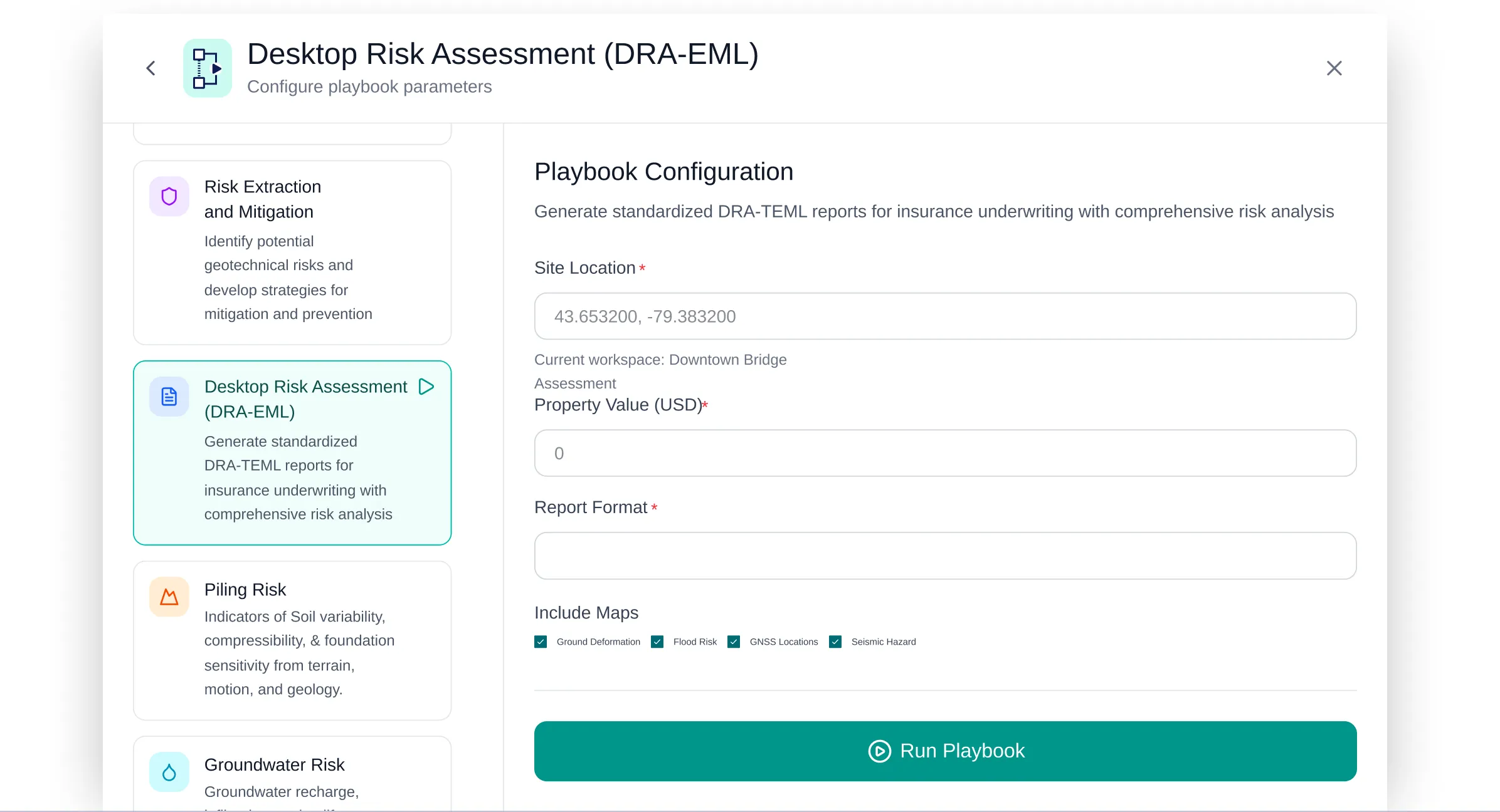
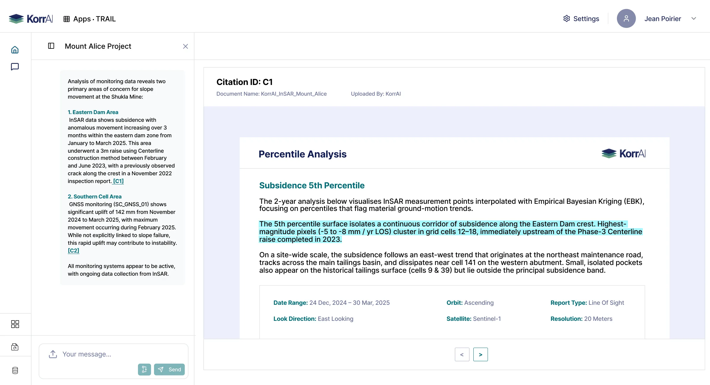
Each run is reviewable, auditable and traceable with datapoint/ page level citations.
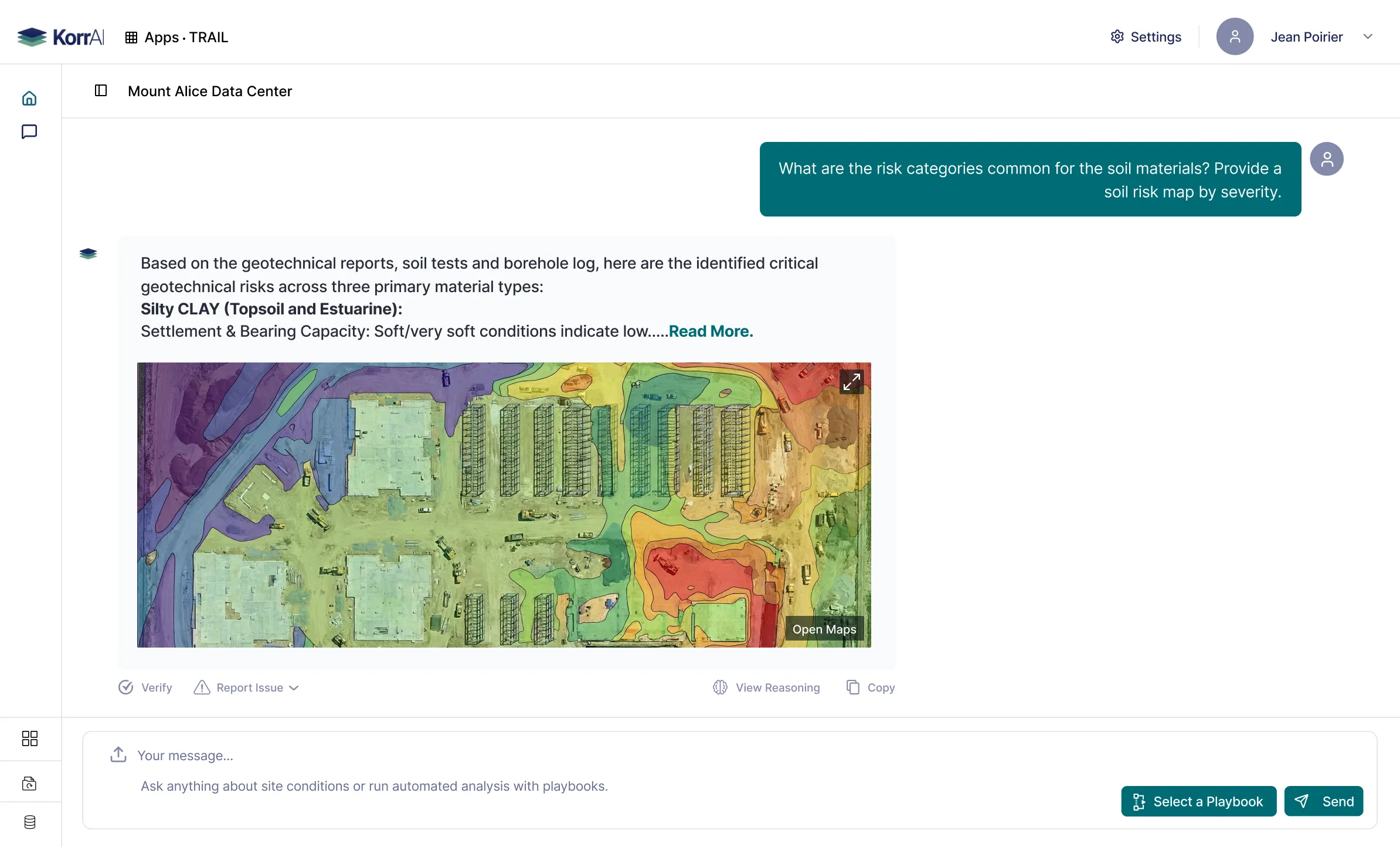
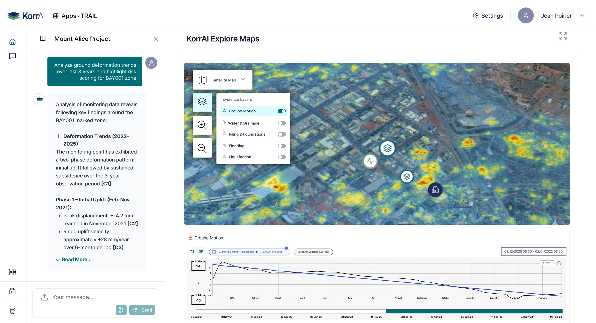
Enable evidence layers over maps, do deeper spatial review. TRAIL plots and summarizes all visualizations.
Playbooks are configured by experts based on established frameworks that deliver standardized outputs.
Desktop Risk
Assessments
Geotechnical and
Foundation Summaries
Water and Drainage
Assessments
Multi-peril Site
Risk Reviews


.webp)
Traceable AI for billion-dollar builds.


.svg)